A-05 · Academic · CEPT University · In progress
Unmaking theperennial river
The Sabarmati at Koteshwar
- Studio
- Current studio, CEPT University
- Location
- Sabarmati at Koteshwar, Ahmedabad
- Year
- 2026 · in progress
- Role
- Individual studio project
- Methods
- Mapping, interviews, field documentation
Brief
Understanding the Sabarmati through its changing ecological, social and spatial conditions. Work so far has focused on site observation, mapping, field documentation and interviews, and on the relationships between the river, infrastructure, local communities and changing patterns of access.
As the riverfront extends to Koteshwar, the open river edge — once shared by farmland, forest, wildlife, temple visitors and daily rituals — is being replaced by a fixed, controlled edge.
- Stage
- Mid-semester
- Site sections
- 13, with a 1:2500 site plan
- Lens
- Environmental justice — who benefits, who bears the burden
Process — research to detailing
-
Observation
Thirteen site sections along the Koteshwar stretch, a site plan, and photographs of construction replacing open ground.
Site plan, sections and photographs
-
Interviews
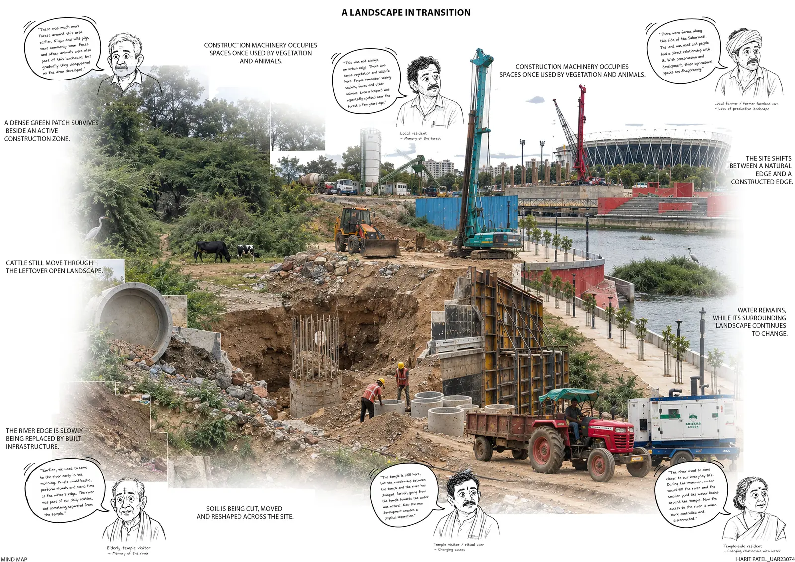
Residents, farmers and temple visitors describe a river that used to be part of daily life — and the forest, foxes and nilgai that have gone.
A landscape in transition — mind map
-
Mapping change
Three layered isometrics, from shared landscape to transition to developed edge, with the forest, farmland, water bodies and wildlife that are lost or reduced.
When the landscape changes
-
Access
Before development, people and animals walked straight to the water for bathing, rituals and daily use. Today access passes through a fixed, controlled edge.
River access — before development and today
-
Strategic responses
In-situ redevelopment without displacement, a community benefit zone, room for vendors, native replanting, a safe construction edge, a development boundary and buffer, a flood-resilient stepped landscape, and a public link between Koteshwar Temple and the river.
Reconnecting the river edge
Next project · P-03
Keep scrolling to the end of the page to open it.